Ken Endean tries a two-anchorage strategy when cruising the Isles of Scilly and overcomes stormy conditions. He advises you on how you can do the same.
Mary and I are very fond of the Isles of Scilly. In fact, we regard the archipelago as the most delightful cruising destination to be found anywhere around the British Isles or North West France. We often encounter other cruisers who have been making regular, annual pilgrimages to this Atlantic outpost, drawn by the clear water, golden sands and oceanic scenery.
We also know sailors who never quite get there, possibly deterred by the location and by published warnings to the effect that there is no place with all-round shelter against bad weather. Isles of Scilly enthusiasts accept that they may have to move between different moorings and anchorages, according to the wind direction.

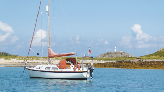
Tean’s south anchorage is sheltered from northerly winds. Photo: Ken Endean
Even so, under certain conditions it can be difficult to decide on the best course of action, particularly if the wind is expected to undergo a major directional shift while continuing to blow strongly, so that any move has to be made at the height of the gale. Those Scilly enthusiasts usually gain a lot of experience from every summer cruise, especially if it is not very summery. However, there is always more to learn, so in 2022 we tried a new combination of anchorages.
Isles of Scilly storm shifts
Bad weather can assault the Isles of Scilly from any direction, but we’re going to focus on fairly typical summer gales, as caused by depressions tracking in from the west and passing to the north of the islands. This is likely to induce the classic weather sequence familiar to all sailors in home waters: a wind that backs to south, then strengthens and veers, finally going round to NW as the low-pressure spirals away to bother the North Sea. If the depression’s track takes it very close to Scilly the wind might start by backing to ESE and finish with a sharp, squally veer, meaning a larger directional swing and extra violence. That happened in 2021, when Storm Evert caused mayhem, and ever since then we have been conscious it could happen again.
Wind force is not the only problem. Even if a yacht is securely moored or anchored in the lee of an island windbreak, the crew may be troubled by waves or swell bending around the land mass. Rolling at anchor will be unpopular with the cook and even more unpopular with anyone who feels seasick. Anchorages on the perimeter of the group may also be unsafe; Porthcressa, on the SE side of Hugh Town, appears to be only open to SE winds, but large waves and swell from the SW have been known to swing right round and into the anchorage, arriving as heavy breakers. Watermill Cove, on the northern side of St Mary’s, seems to be less vulnerable to swell but a wind that veers to NW will blow unimpeded through Crow Sound and through the anchorage.
Article continues below…
How this novice couple sailed to the Scilly Isles and back
They say ‘do something that scares you a little bit every day’, and while we weren’t looking for fear, we…
Cruising the Scillies and Gurnsey: ‘All was well in our little world’
Now in his 82nd year, my father Ewen reluctantly ended a nearly 50-year relationship with his much-loved and well-used succession…
Looking for comfortable corners
Cosier hiding places can be found between the islands, but they’re not perfect either. Hugh Town Harbour is fine until the wind veers towards west, when the visitor moorings in the north of the harbour become fully exposed and chaos may ensue: during Storm Evert several boats were damaged or driven ashore. Even escaping could be difficult because the buoys are very closely spaced. On one occasion we were caught in the harbour when a thunderstorm swung the wind to WNW; it was only fresh but another yacht had rafted alongside us, on the same mooring, and the two rigs were threatening to clash together.
It was clearly time to move but from the middle of the mooring group we had to cast off, gain steerage way from a standing start and then wriggle clear of the neighbouring boats while they were all dancing around wildly. On that occasion, we motored upwind for a mile or so and anchored under Tresco’s Crow Point. This spot is between rocks but several above-water heads actually serve as handy beacons for the navigator. There’s one golden rule in Scilly pilotage: learn to recognise the rocks!

London Apprentice anchored at Tean, on a clean, sandy bottom. Photo: Ken Endean
New Grimsby Sound is widely regarded as the best refuge in Scilly, with deep water and good protection from all winds except S and NW. However, some of the anchoring areas are obstructed by private moorings, while if bad weather is forecast there are unlikely to be any vacant visitor buoys. It was those S and NW winds that caused grief during Evert, when some moorings and anchors dragged, the anchors coming up swathed in weed. That illustrates another golden rule in Scilly anchoring: wherever possible, eyeball the sea bed and try to ensure that the hook is on light-coloured sand rather than dark areas of weed.
Weed may foul the anchor and it grows on rock or boulders, which may not give the fluke much to hang on to. If no sand is visible, we try to assess the sea bed materials by putting a hand on the anchor chain to sense whether the fluke is dragging slowly through soft stuff, rumbling over rock or working its way into firm resistance.
If wind and waves from NW make New Grimsby Sound uncomfortable, a visitor could escape downwind – perhaps to the Crow Point anchorage – although that will involve a rapid, hectic passage over Tresco Flats, around the beacons and rocks.

Dining room with a view: the terrace of the Seven Stones Inn on St Martin’s. Photo: Ken Endean
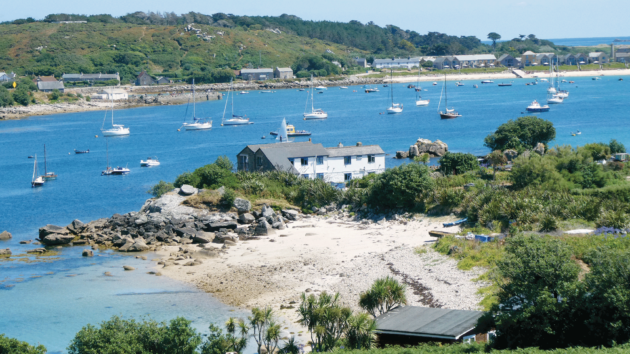
If the boat can take the ground, it could also move to the Sound’s most secure anchorage, in Bryher’s Green Bay, which has good protection from NW and a bed of firm sand. Many owners regard this as the best ‘hurricane hole’ in the islands. We used it successfully during Evert, although there was an initial spell of strong wind from the south, before we were fully sheltered by Bryher. There was one other drawback: the bay was crowded with boats and if any of the upwind vessels had dragged that could have caused a damaging tangle.
Dodging a wind shift
Before settling on Green Bay, we had considered Old Grimsby, which has more anchoring space, but decided against staying there because we expected a fierce veer to NW, which would scream down Old Grimsby Sound. During Evert this actually happened and a couple of boats that had anchored on weed dragged for a long way, ending up on rocks. However, in 2022 we tried a new dodge. We were lying at Old Grimsby, fairly close inshore, but in a Force 6 SW wind that was predicted to veer to NW during the night, we chose a two-anchorage strategy.

Green Bay is usually secure but may be crowded. Photo: Ken Endean
At 1700 conditions were very blustery but in the lee of Tresco the water was flat. We raised the anchor, unrolled some jib and cruised down the island’s flank, then hooked in around Lizard Point to re-anchor in Pentle Bay (see diagram on left). By keeping the land mass between us and the weather, that short passage was completely stress free and would have been equally feasible in a full gale.
The strong SW wind was ripping the water’s surface into small, angry waves, but the fetch was short and with no tidal stream London Apprentice lay quietly until she touched down at low tide. By breakfast time the wind had gone round to NW and we were delightfully sheltered by a bank of trees. One of the boats that had been at Old Grimsby was anchored alongside us; the crew told us that our move had caused puzzlement until the early hours of the morning when the wind veered and the attractions of Pentle Bay suddenly became obvious.
Detailed research
In 2023, we had another look at the eastern side of Tresco in order to learn more about the anchoring options. First, we anchored at Old Grimsby, at position A on Diagram 4. Several other boats were in the middle of the channel, at Position B, and the wind was SW Force 5. When the tidal stream began flowing to the NW they began rolling vigorously while our position seemed even calmer. This was an instance of current-induced wave refraction.

New Grimsby Sound is open to wind and waves from the NW. Photo: Ken Endean
When waves meet a tongue of contrary current the crests are ‘bent’ into the current (see diagram above), so that wave energy is trapped in the current while adjacent areas become calmer. Those trapped waves may progress upstream, even around bends in the channel, and in this case, waves from SW were turning clockwise by 90⁰ to roll in through Old Grimsby Sound.
A yacht anchored at Position C was lying across the stream but hardly rolling at all. The current would have been weaker at that location, because the Sound is wider, and the waves would have been more dispersed. The anchorage zone between Block House Point and Great Cheese Rock therefore makes a good alternative to Old Grimsby.
We had never seen yachts anchored in Pentle Bay but Tresco’s shop, public shower, laundry and semi-tropical Abbey Gardens are all within a mile’s walk, and later we returned for a second look. The Admiralty chart shows the sand flats in the north of the bay as drying by between 1.2m and 1.8m but we found a deeper area at position D, close to the toe of the steeply-sloping upper beach, and scoured by wave action, where the drying height was only 0.5m.
For boats with single keels and without beaching legs or twin rudders, a good example was set by a French yacht that anchored at position E, further out but still fairly well protected and in deeper water. The chart showed depths of 0.2m to 0.8m below chart datum but on most days there will be extra depth because MLWS and MLWN are 0.7m and 2.0m above chart datum. The sand in that area moves around, so use the echo sounder to check for a deep spot. And there’s a third golden rule for Scilly: for yachts that cannot take the ground, neap tides offer more options.

Snug at anchor in Pentle Bay, sheltered by Lizard Point. Photo: Ken Endean
Relaxing after the veer
When a depression passes the islands and the wind veers to NW, this opens up more options for anchoring, although New Grimsby, Old Grimsby, Watermill Cove and Hugh Town will still be pretty draughty. We would normally head for St Martin’s, an island overlooked by many yacht crews but with some fine walking country.
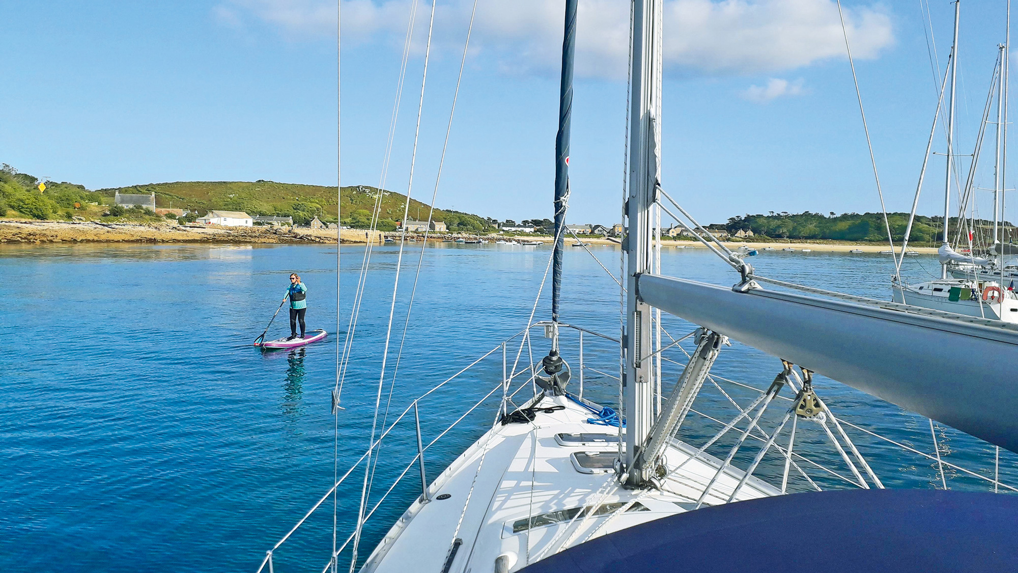
Our favourite anchorage here is the sandy bight south of Tean (Position F), where we could either take the ground or anchor on the edge of the sand and lie back over deeper water, clear above the cable that runs along the channel. From this position it is only a short dinghy trip to St Martin’s. Alternatives are Higher Town Bay or Tean Sound, which is deeper. It used to be obstructed by moorings that belonged to the nearby hotel but in 2023 those had been removed and there was more room to anchor. Just take care to check the holding, as much of the bed is weedy.

Waves rolling through the mid-channel anchorage at Old Grimsby. Photo: Ken Endean
On St Martin’s the shops sell provisions but there is no public tap for fresh water. However, the Seven Stones Inn has a new facilities block with showers and washing/drying machines, all intended for use by visiting yachts. It was being completed in 2023 and the management were happy to provide drinking water, although customers must carry it away in containers. The inn’s terrace also has one of the best restaurant views in the country, which is an excellent reason for enjoying a slow lunch while your washing is churning away.
Explore and learn
The Isles of Scilly are surprisingly complicated for such a small area, but some of those complications provide valuable protection for yachts, so it’s a good idea to spend time planning your trip before you set off, studying all the features and the ways in which wind, water and waves flow around them.
When the weather turns angry, such knowledge is useful and more knowledge means more safety.
Enjoyed reading this?
A subscription to Yachting Monthly magazine costs around 40% less than the cover price, so you can save money compared to buying single issues.
Print and digital editions are available through Magazines Direct – where you can also find the latest deals.
YM is packed with information to help you get the most from your time on the water.
-
-
- Take your seamanship to the next level with tips, advice and skills from our experts
- Impartial in-depth reviews of the latest yachts and equipment
- Cruising guides to help you reach those dream destinations
-
Follow us on Facebook, Twitter and Instagram.


