Do you know how close you can get when anchoring a boat near shore? James Stevens answers your Questions of Seamanship
Anchoring a boat near shore: how close can I get?
Question:
It is a sunny midsummer’s day. Toby and Helen have decided to take their 10m production yacht to a favourite bay and anchor for lunch.
Conditions are ideal, a gentle offshore wind, hardly any swell and the tidal streams in the bay are very weak.
Unsurprisingly they are not the only ones with the same idea; the sandy bay is full of anchored yachts.
However, when they arrive a yacht is just leaving from the best position, close inshore.
Helen looks up the tides. The nearest port with a tide table is 15 miles away and gives the time of low water as 1300 BST and the height of 0.3m. Their yacht draws 1.9m.
Toby looks at his chartplotter, he reasons that if he stays on or to seaward of the 2m contour he should be fine in the calm conditions.
He works his way in keeping a careful watch on the chartplotter until he is on the 2m contour.
There seems to be room to anchor.
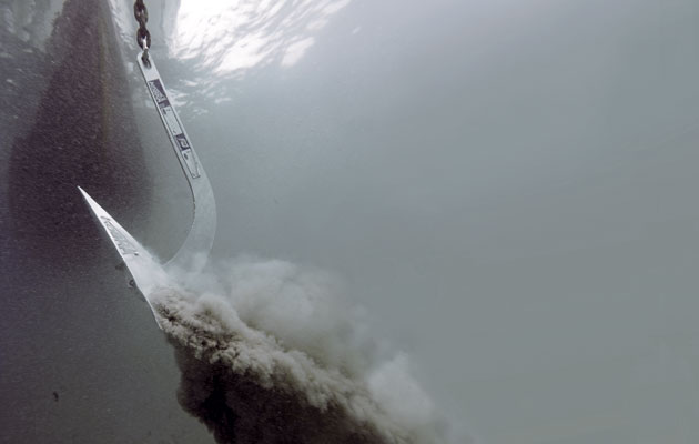
Helen takes the helm and Toby prepares the anchor, lowering about 20m of chain.
The yacht settles to the anchor. The sun is hot, the beach close by, time for a swim ashore. But is the boat safe?
Continues below…
Anchoring: 7 common problems solved
Yachting Monthly experts share the problems they have most often faced when anchoring, and how they troubleshoot their way out
Expert advice: best boat anchoring advice
When it comes to boat anchoring many different people have their own view on the best boat anchoring techniques to…
Best anchors: 8 new generation designs suitable for every boat
Good ground tackle and understanding how to anchor properly opens up the option to stay overnight in stunning bays and…
How to choose the right anchor
Which of the many anchor designs is best for your boat? Vyv Cox helps you choose the best anchor for…
Answer:
They have assumed that a tide table for 12 miles away will be accurate where they are.
In many places the standard port times and heights vary only slightly 15 miles along the coast.
Other stretches of the British coastline have really significant differences in range over comparatively small distances.

James Stevens, author of the Yachtmaster Handbook, spent 10 years as the RYA’s Training Manager and Yachtmaster Chief Examiner
For example, the spring range at Yarmouth, Isle of Wight, is 2.2m, while at Portsmouth, 18 miles away, it is 3.9m.
The main reading they have missed is the depth at the time of anchoring.
They have assumed the chart is accurate to a small fraction of a metre in the bay.
Their plotter is giving a position to an accuracy of a few metres but the chart depth display is only as good as the last survey, which in a bay not used by commercial shipping was probably some time ago.
Therefore there is no guarantee the 2m contour line, probably drawn freehand by the hydrographer, is actually telling the truth.
Although the chart is essential to see if there are any hazards such as rocks and to establish the nature of the seabed.
They should first establish the times and heights of high and low water at the bay as best they can.
The plotter may give this information or they may have to interpolate between two ports with tidal information.
They then need three key numbers.
The distance the tide will fall from the time of arrival to low water, the draught of the yacht, and the safety clearance required at low water.
Add these three things together, anchor in a greater depth and stop focusing on the 2m contour.
Is the boat safe? More than likely but it’s not a certainty.
Enjoyed reading Anchoring a boat near shore: how close can I get??
A subscription to Yachting Monthly magazine costs around 40% less than the cover price.
Print and digital editions are available through Magazines Direct – where you can also find the latest deals.
YM is packed with information to help you get the most from your time on the water.
-
-
- Take your seamanship to the next level with tips, advice and skills from our experts
- Impartial in-depth reviews of the latest yachts and equipment
- Cruising guides to help you reach those dream destinations
-
Follow us on Facebook, Twitter and Instagram.


