St Catherine’s Point

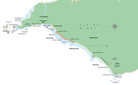
St Catherine’s Point, at Niton Undercliff, marks the Island’s southernmost extremity and the lighthouse there, flashing once every five seconds, is visible for 26 miles. The current light was built in 1838, two years after the loss of the Clarendon. She was a three-masted ship en route from St Kitts to London with a cargo of rum, cedar, sugar and coconuts in the hands of her First Mate Samuel Walker, her original skipper having died in Nevis before the voyage. Once past the Lizard a northwesterly gale sprang up preventing her from seeking refuge in Plymouth so she pressed on for Portsmouth.

It’s thought Walker mistook the Needles light for that of Portland and closed the shore. According to The Times “The gale increased to a hurricane, at the same time chopping to the southward, and drove them with tremendous violence on the fatal beach.” The beach was under Blackgang Chine and the ship struck at 0550 on 14 October 1836. Islander John Wheeler tied a rope around his waist with four men to haul him back ashore, and strode into the maelstrom to rescue three seamen who had jumped as soon as she struck. Twenty-four died.
St Catherine’s Lighthouse was originally 13m taller than it currently is but, because the light was often shrouded in mist, the decision was taken to shorten the tower. Though this light was inspired by tragedy, the original light was borne out of guilt. The original light, now known as St Catherine’s Oratory or more colloquially as the Pepper Pot, was built in 1328 on the instruction of Lord of Chale, Walter de Godeton.


